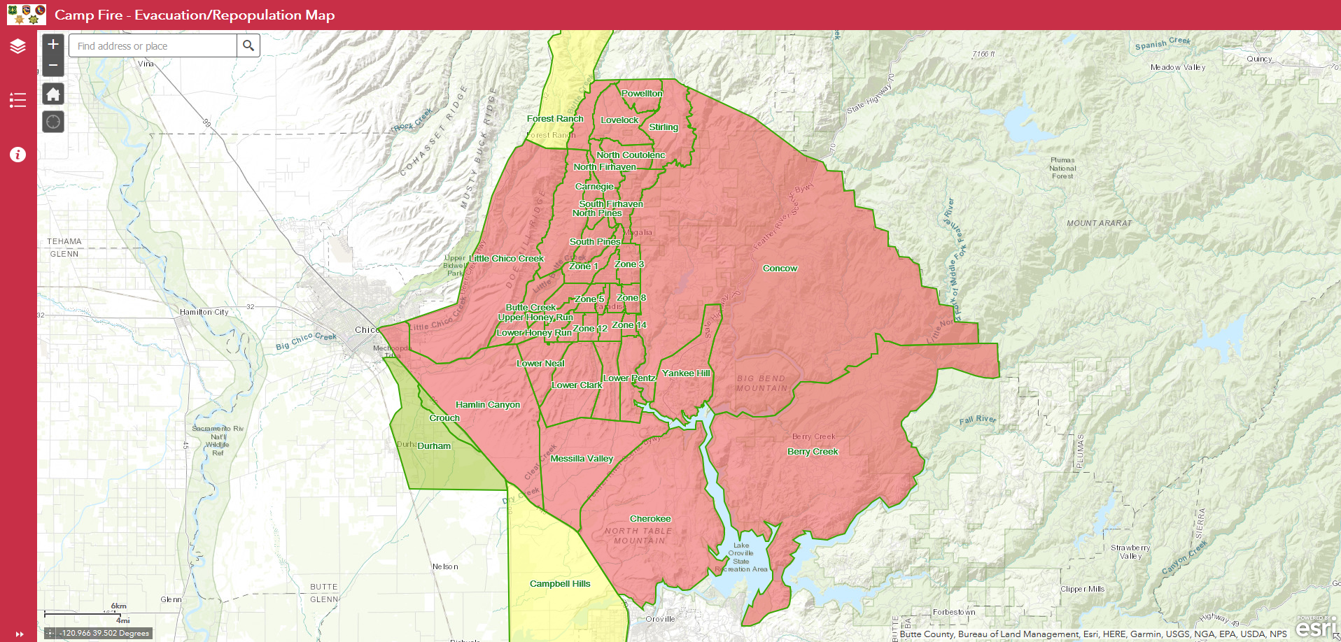
Authorities have released a map showing the areas currently under evacuation orders and warnings due to the Camp Fire.
The interactive map also shows areas that are being repopulated.
The Camp Fire, which broke out on the morning of Nov. 8, has burned 113,000 acres and destroyed more than 6,400 homes. It’s blamed for at least 29 deaths.
The cause is still considered to be under investigation, but PG&E told state regulators last week it detected a problem on an electrical transmission line near the town of Paradise minutes before the fire broke out Thursday.
The fire is 25 percent contained, but firefighters say the blaze was active all night long and jumped 300-feet across a portion of Lake Oroville at least three times.
Camp Fire Incident Video Update 11.12.18 #CampFire @ButteSheriff @townofparadise @CHP_Valley @CountyofButte @CHP_Oroville @chicofd @chicopolice pic.twitter.com/82JnmsVBiK
— CAL FIRE Butte Unit/Butte County Fire Department (@CALFIRE_ButteCo) November 12, 2018
More than 4,500 firefighters are assigned to the fire.
