Cal Poly’s latest CubeSat is sending back high-resolution photos of Earth.
The university’s ninth CubeSat is testing ways to reduce vibrations on orbiting satellites, but it’s also taking pictures.
It goes by the name of DAVE, which stands for Damping and Vibrations Experiment. The softball-sized satellite launched from Vandenberg Air Force Base in September with three other small satellites, or CubeSats. They were launched on NASA’s ICESat-2 mission.
A student-run research lab called PolySat released its first high-resolution image Tuesday. It was taken just hours after the launch.
Cal Poly says the photo shows Svalbard, the Norwegian archipelago located between Norway and the North Pole.
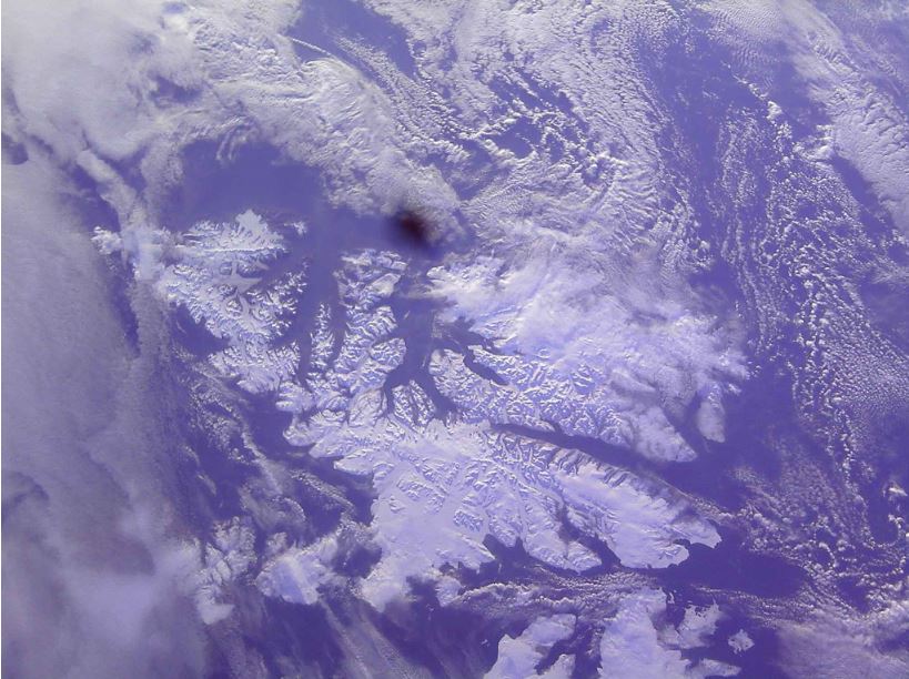
“This is one of our better pictures,” said Grigory Heaton, a senior studying aerospace engineering and physics. “Our satellite is not controlled. It’s just spinning, so we have to get lucky with the pictures. This one, we were right overhead and got almost the entire archipelago.”
It’s not easy to capture images from the satellite. It takes 45 minutes to download a 1.3-megabyte image from the satellite, and students have to contact the satellite as it passes over campus. They first get a fuzzy, low-resolution thumbnail while a full-size photo downloads. Typically it downloads in 8-minute increments over several days.
The camera lens was damaged during the launch so all of the images have a dark splotch near the center.
PolySat is sharing low-resolution versions of the images the satellite captures on the group’s Facebook page and plans to share the full-resolution images as they download.
